
Year: 2010
A San Francisco Fantasy Map
Click on image to view the complete map. Often times my thoughts turn to other cities. This fantasy map for rail-based transit in San Francisco is the culmination of some of those thoughts. Introduction / Mission Bay Station The premise...
Illinois May Receive More Money for High-Speed Rail
According to the Wall Street Journal and New York Times, the White House is going to redirect high-speed rail money previously allocated to Wisconsin and Ohio to other states including Illinois. Congressional sources say the Obama administration is taking $1.2...
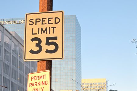
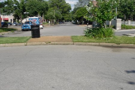
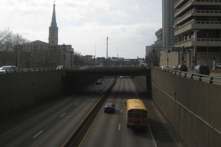
Speeding Through Downtown at 35 MPH
4th St. at Spruce St. The speed limit on the majority of streets in the St. Louis CBD is 25 mph. Outside the CBD, but still within downtown, speed limits are commonly set at 30 mph. Some of the arterial...
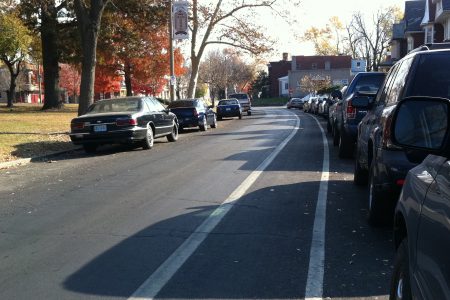
Fountain Park Bike Lane in the Door Zone
Streetsblog San Francisco recently posted an excellent article titled “Why Are We Building Bikes Lanes That Are Hurting People?” The premise of the article is that many bike lanes are marked too closely to rows of parked cars putting cyclists...
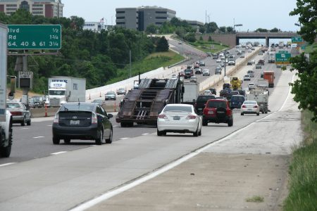
MoDOT Trying to Squeeze More Capacity Onto I-64, Too
MoDOT has ambitions to add capacity to I-64 between I-270 and MO-141, if its recent failed TIGER grant application is anything to go by. Much like its planned project on I-270 between I-44 and Manchester Rd, MoDOT plans to add...
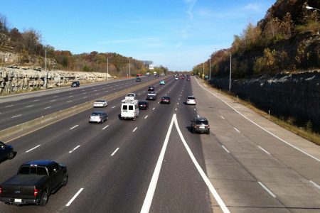
MoDOT to Squeeze Additional Capacity Onto I-270
Come 2012, commuting on I-270 between I-44 and Manchester Rd will become a little easier and faster. MoDOT is planning on adding an additional lane in each direction to portions of the route, reducing travel times by up to two...
Let Bikes Through
Biking is relatively easy across most of the City of St. Louis. The street grid makes it easy to get around and easy to find a street with light vehicular traffic… most of the time. Other times, biking within the...
Does Laclede’s Landing or the Arch Need Washington Avenue?
MVVA, the winning design team in the Arch grounds competition, proposes closing Washington Avenue from Memorial Drive to the Mississippi River. The competition jury, on the other hand, had very strong feelings towards keeping the road in place. Washington Ave...
Memorial Drive Parking Garage
Parking was a major concern of many of the design teams in the Arch grounds design competition. For example, from the narrative of the MVVA team’s winning proposal: Our proposal instead harnesses the power of parking, and spreads it over...
The Arch Parking Puzzle
Parking at the Arch grounds is, today, singularly focused on the existing parking garage at the north side of the Arch grounds which has 1224 parkings spaces. By 2015, the garage will almost certainly have fewer spaces as every single...
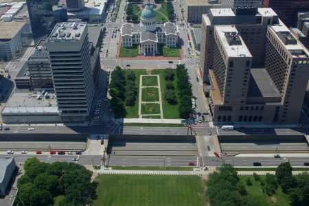
Should Memorial Drive Be Closed to Vehicles?
The Arch grounds design competition currently underway could potentially bring about major changes to Memorial Drive and the western border of the Jefferson National Expansion Memorial. Every design team proposes a cap over I-70 between Chestnut and Market which would...
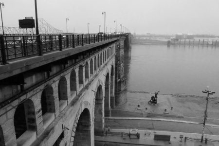
On the Eads Bridge, Another Chance to Reclaim Space for Pedestrians and Bicyclists
The Eads Bridge closed on December 15, 1991 to facilitate construction of stations for the soon to be MetroLink light rail line. Unfortunately, construction uncovered severe corrosion on many of the trestles supporting the road deck resulting in the road...